by Gabriela Schaepman-Strub
August 1, 2013
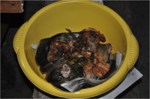
The regular reader of this blog might have noticed that the original group has split up into two parties: Maitane Iturrate and Inge Juszak will be staying for another 2 weeks in the field site at Kytalyk to continue the measurements, while the rest of the party has left the core site. We first travelled to the north of Chokurdakh to explore the Оyotung (Оиотунг) hill-site area as potential new measurement site. A well-drained area, with highest hills reaching more than 300m a.s.l. The Soviet Union army constructed a gravel road to the top hills, leaving two heavy machines behind. The top of the hills are covered by lichen tundra, with increasing plant diversity towards the river lowlands. The zone along the Indigirka shows the highest plant diversity. Beautiful flowers, including thyme and arnica, reminding us the Swiss alpine flora. Oyutung was a special experience. We originally planned to visit this site for a few hours only, on the way to Russkoe Ustje. As the trip to the north was not possible as planned, a group of biologists and zoologists offered us to stay with them for a few days. Their cook provided us with fish for breakfast, lunch and dinner and with tea, all cooked on the open fire.
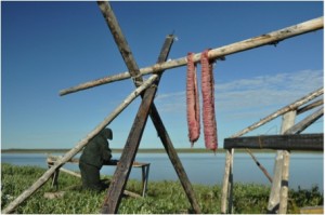
At Oyotung there was a small fishermen’s hut where we could sleep, three persons on old, narrow sofas, two on the floor. During the last night, two local young men entered the hut, bringing some Jukula (air-dried fish) as a present for Maxim (whoever this is…). They had heard that somebody was using their hut and wanted to check – at 5 am…. They were obviously quite drunk and just wanted to find a place to rest, but we had to argue very carefully not to make them upset. When Michael got up and talked to Olga in English they finally understood that we were foreigners and immediately said – no problem. Olga, knowing how to deal with such situations, sent them to the big house where the local cook told them to leave. We finally heard their boat going off and felt asleep again. The next morning we drove to Chokurdakh on a very still Indigirka and flew out to Yakutsk. Lucky again with the flight, wonderful weather and beautiful views!
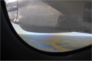
Last views over the Chokurdakh area on our flight back to Yakutsk. What a landscape, accessible only on the rivers or through the air as most of it is covered by lakes, rivers, and wetlands. Photo: G. Schaepman-Strub, July 2013.
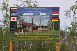
After a dinner back in civilization (the best salad I ever had in my life 😉 Olga left us for St. Petersburg. On Sunday we were invited by Trofim Maximov to visit Spasskaya Pad, a research station of the Sakha Fluxnet. The site hosts two carbon and energy flux measurement towers of 32 m, reaching above the forest canopy, one in larch forest, the other one in a pine dominated forest. What an experience to climb up and see the forest from the top! These towers provide some of the very scarce observational data of the extensive continuous permafrost area in NE Siberia, with continental climate, to the scientific community. Thank you Trofim, Vasya, Stas, Roman, cook, and all others for safely driving us to the station, hosting us, guiding us through the site, for the bania, the tasty shashlik and mushrooms, and the soccer party!
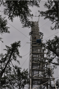
Climbing the instrumented flux measurement tower at the larch dominated site in Spasskaya Pad. Linus felt that it was quite windy at 32m…. Photo: G. Schaepman-Strub, July 2013.
While being in and around Yakutsk, we are preparing the documents for exporting our soil samples and discuss with our collaboration partners about future work and infrastructure needed on the Kytalyk site. October is approaching fast, that’s when we will need to submit a detailed research plan (exact location, frequency of data logging, etc.) for summer 2014 to the Russian authorities for their approval. If any big infrastructure or wood for boardwalks needs to be sent north, this should be done in winter time by truck on the frozen rivers, so better to start planning soon! But now it is first time for a few days of vacation to explore the area around Yakutsk! Maitane and Inge will keep you updated in the meantime about the last days of the field campaign in Kytalyk.
PS: Check SRF 4 – heute morgen. I was interviewed over the phone lately and the journalist promised that they will report about our activities on Friday morning.
PPS: The excursion to the Lena pillars was terrific! An interesting boat drive with visits to rock paintings and exploration of the flora. Finally arriving at the pillars – a foggy day, a mystic atmosphere! We were climbing the pillars and had a beautiful view over the immensely wide Lena.
How fortunate we were, visiting this Unesco world heritage site (since 2012) and not meeting any other person! http://whc.unesco.org/en/list/1299/
We can definitely advise to all researchers travelling through Yakutsk to take a few days off and get to know this tourist-free region! Beautiful landscapes and flora, very special! If you need help for your trips you might want to check this website http://askyakutia.com/ or get in contact with Bolot Bochkarev who helped us getting around.
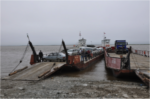
Ferry boats crossing the Lena river remain an adventure for us. Photo: G. Schaepman-Strub, July 2013.
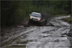
On the way to the Lena pillars with our experienced off-road driver Nikolai (Kola). Photo: G. Schaepman-Strub, July 2013.
What seems to be an off-road track is indeed a regular road between two villages. Yakutsk is the capital of a Republic of almost the size of India, yet there are not highways, and dirt roads start immediately outside of the city. Even within a distance of 100km of the city it is advised to use a 4 wheel-drive vehicle. Road conditions are severely impacted by permafrost dynamics and flooding. Winter time allows travelling on the well-maintained ice-roads on the Lena, an experience we save for next time….
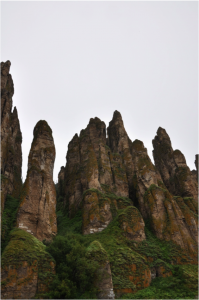
The Lena pillars are located within several kilometers along the Lena river, and are partially covered with vegetation which makes them very special. We walked up to the top at one point (about 2 km path, quite steep ;-), felt like walking through a rain forest as the air was very humid, lots of mosses and lichens on the floor and trees. Photo: M. Schaepman, July 2013.

