This post is also available in:
 Deutsch
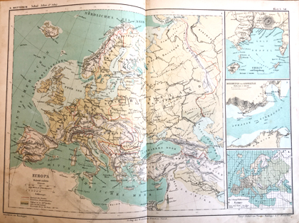
Heinrich Wettstein (1831-1895), a teacher and member of the department of education in Zurich, developed numerous text books for various branches of the natural sciences and was involved in the creation of a new school atlas. Johannes Randegger (1830-1900) from Winterthur came from a poor background. Thanks to his great talent for drawing, he was offered the chance to join the newly founded topographical institute of Jakob Melchior Ziegler in 1842 at the age of twelve. He started as an apprentice, then became an employee and in 1863, after a study visit to Paris, even a partner and in charge for the publishing house. Randegger produced numerous school and wall maps and edited Heinrich Wettstein’s school atlas.
The Wettstein and Randegger school atlas was first published in 1872. Until then, atlases had to be purchased from abroad, but now a Swiss atlas was available for the first time, and it was widely used in many cantons for the next 25 years. It was replaced in 1903 by the Schweizerischer Schul-Atlas zum Gebrauche an Gymnasien, Sekundar, Real und Bezirksschule by Wilhelm Götzinger and Jakob Schlumpf. At the first meeting of the newly created Erziehungsdirektoren-Konferenz on 27 July 1898, the compilation of a new atlas was discussed and 1899 decided upon, this time with the support of the cantons and the Confederation. In 1910, the Atlas für schweizerische Mittelschulen was published in German by the Erziehungsdirektion Zürich. The French edition followed in 1912 and the Italian in 1915. Many readers will be familiar with a version of that atlas from their own school days. For more than 100 years, the atlas, Schweizer Weltatlas today, has been in use in schools, these days with additional online materials.
A digital version of the Schulatlas by Wettstein can be accessed on e-rara.ch. This exhibit and other atlases from the 18th and 19th centuries are shown in the exhibition «Exploring the world» on floor J of the Main Library – Science.
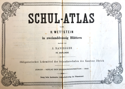
Heinrich Wettstein: Schul-Atlas von H. Wettstein in zweiunddreissig Blättern. Obligatorisches Lehrmittel der Sekundarschulen des Kantons Zürich. Bearbeitet von Johannes Randegger. Zürich, Verlag der Erziehungsdirektion 1886