This post is also available in:
 Deutsch
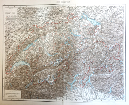
The atlas of the geographer and ethnologist Richard Andree (1835-1912) was published between 1881 and 1937 in various editions. The volume shown in the exhibition is the second edition with 120 maps. Zinc plates were used to produce the maps in this atlas, as these allowed a finer gradation of colours than chromolithography. Shown here is the detailed map of Switzerland.

A digital version of Andree’s Handatlas can be found in the Rechercheportal. This exhibit and other atlases from the 18th and 19th centuries are shown in the exhibition «Exploring the world» on floor J of the Main Library – Science.
Richard Andree: Richard Andrees allgemeiner Handatlas in hundertzwanzig Kartenseiten, nebst alphabetischem Namenverzeichnis. Herausgegeben von der Geographischen Anstalt von Velhagen & Klasing in Leipzig. Zweite vermehrte und verbesserte Auflage. Bielefeld, Velhagen & Klasing 1890
