This post is also available in:
 Deutsch
Are you looking for geoinformation on Switzerland? Search the Swiss Geoportal, which provides geodata on various topics.
geo.admin.ch is the geographic information platform of the Swiss Confederation within the Federal Administration. The portal is an important step in the implementation of the Geoinformation Act: the platform records the official geodata of each federal office, so that the data is available quickly, clearly and completely via a single web address. The geodata can be obtained directly from the corresponding federal office. The metadata are provided free of charge by geocat, Switzerland’s geographic metadata catalog. The download of geodata is free of charge with certain restrictions (cf. terms of use).
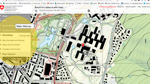
The Mapviewer from geo.admin.ch allows geodata to be viewed. It is an intuitive application for searching, displaying and using geographic information. The desired data are available as digital maps and photos, vector data and also as online services.
Users can customize many map parameters such as the map section and image size as well as the type of information displayed and the cartographic background.
The result displayed on the screen can be printed on paper, saved or shared. Additional information linked to the displayed geographical objects can also be displayed.
Tips and Tricks -> Mapviewer Help