by our staff writers
June 29, 2013
No mobile phone tower nearby, project loon (balloon-powered internet access) not yet arrived in Kytalyk, and some communication satellites do not provide guaranteed coverage in our location (such as Thuraya and Inmarsat). So how do you communicate in such a remote location?
Luckily there is a constellation of 66 active LEO (low Earth orbiting) satellites, operated by Iridium. LEO satellites are located on a (quasi-) polar orbit at about 780 km height.
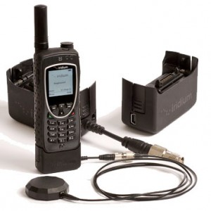
In the field, we use a Iridium 9575 satellite phone for communication. The phone is has a built-in GPS emergency button (SOS messaging) and interface to advanced location based services.

Satellite phone with external antenna (allowing you to call from inside the container, without the risk being attacked by mosquitoes) (Photo: groundcontrol.com).
The satellite phone communicates in the L-band spectrum (1616-1626.5 MHz) and it’s antenna can be used for GPS and phone communication at the same time. You can recognize Iridium numbers since they use the virtual country extensions +8816 and +8817.
There is also a short burst modem on the site in operation with another satellite phone, allowing sending e-mail or other messages.
The SOS messaging of our satellite phone is configured to activate a number of services automatically. First, it will send an SMS with location information to GEOS SAR. GEOS operates a commercial global alerting post for satellite emergency notification devices, providing real time monitoring and response, as well as search and rescue services (SAR). All our expedition participants are members of GEOS SAR. Once SOS messaging is activated, the Intl. Emergency Response Coordination Center (IERCC) will coordinate the rescue operation. At the same time, an e-mail message will be sent to responsible persons at the University of Zurich. And last, it will call a phone number of a responsible person at the University of Zurich. We strongly hope that we do not need to make use of this service.
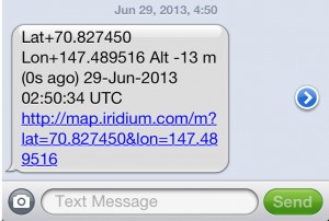
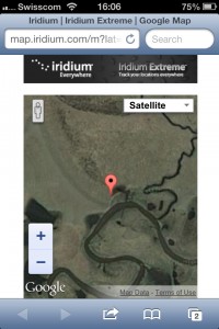
Our location-based services are configured to sending GPS coordinates through an SMS gateway to pre-configured numbers. Once activated we’ll be receiving up-to-date information on position, altitude, date, time, and a link with locations projected on a Google Maps interface.
This is all fine. The risk is as usual in the battery. Satellite phone charging gets priority on the site, where power production and consumption is limited!
This techno–stuff is very interesting, but how do I call them?
Don’t. We won’t post numbers here. Drop us a message if you can’t resist. Usually we send them an SMS through a mail gateway or an SMS service with a call request, since calling from the satellite phone is cheaper than from elsewhere. All expedition participants have been allocated satellite phone time to communicate, as they desire.


